
Here are the highlights for this system based on current National Weather Service (NWS) forecasts:
- What: Heavy mixed precipitation
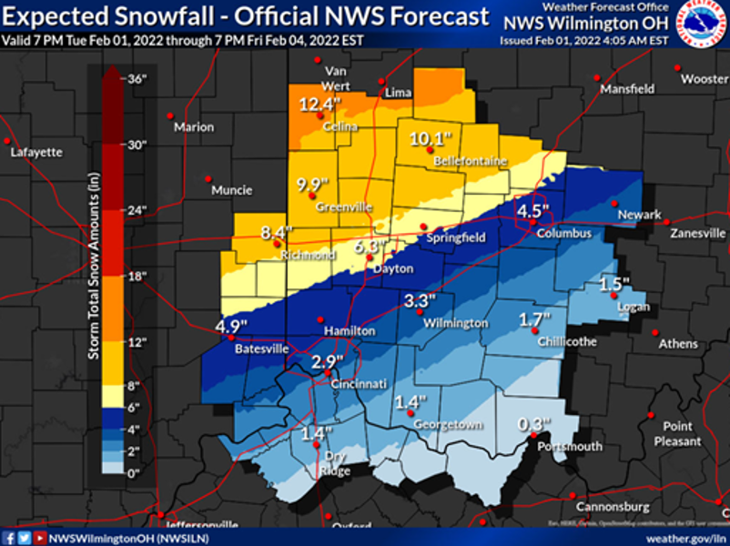
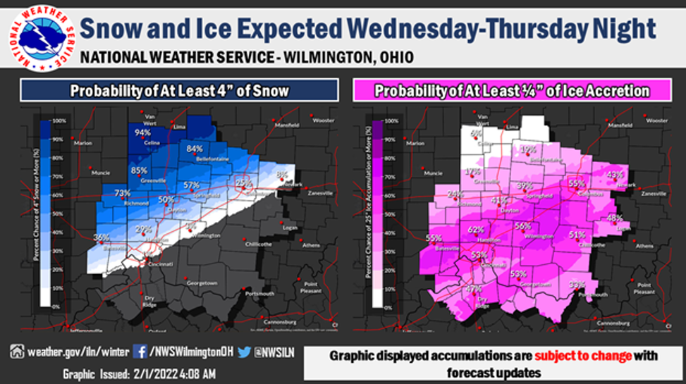
- Snow – potentially 5”to 10” however, there is a slight chance for more.
- Ice – trace amounts up to .2”
- Please note: The forecasts show a very tight precipitation gradient in Delaware County. As such, total accumulations could vary substantially in our area.
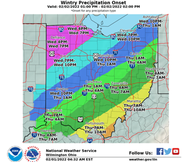
- When: Wednesday afternoon through Friday morning – precipitation onset for Delaware County is expected late Wednesday evening.
- Impacts: Roadways will be impacted by snow and ice. If ice accumulation is sufficient, power outages may result.
- Where: Delaware County and much of Ohio are expected to see impacts from this system.
- Additional details: Very cold temperatures are expected following this system.
Please see the graphics below from the NWS in Wilmington, Ohio:

This information is subject to change as the event draws nearer and forecasts sharpen. We will continue to watch this system very closely and will continue to engage with the NWS and other partners as needed. Lastly, we will post forecast and preparedness information to the office social media pages in the coming days.